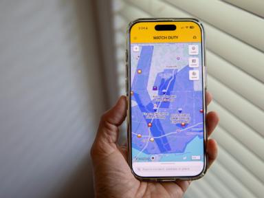
Silicon Valley loves a good crusade, especially when it involves wrapping an app in the flag of public safety. The latest tech gospel claims that because crowdsourced, map-based software helped people track wildfires, we can simply copy-paste that model onto catastrophic flooding.
It is a comforting illusion. It is also fundamentally dangerous.
The tech industry is treating floods like wet wildfires. They are not. Wildfires are slow-motion, linear crises compared to the physics of moving water. Managing flash floods through a smartphone screen ignores how hydrology works, how municipal infrastructure fails, and how human psychology operates under extreme stress.
Crowdsourcing a crisis works when you have time. With flooding, by the time a user pins a flooded intersection on a digital map, the entire topography of the hazard has already shifted.
The Hydrology Problem That Software Engineers Ignore
Fire moves along predictable vectors of fuel, wind, and topography. It stays where it burns until it moves. Water behaves entirely differently. A flash flood is a dynamic, hydraulic event governed by concrete, saturated soil, and micro-topography that digital maps cannot capture in real time.
When tech platforms expand from wildfire tracking to flood monitoring, they run directly into three brutal realities of hydrology.
- The Latency Trap: Fire detection relies heavily on satellite thermal imaging and human spotters who see smoke plumes from miles away. Flood detection requires physical gauge readings and immediate hydrodynamic modeling. If an app relies on user-submitted data during a torrential downpour, the information is obsolete within ninety seconds. A street that was clear two minutes ago can become a lethal trap before the app update pushes to the cloud.
- The Velocity Distortion: Standing water is a nuisance; moving water is a weapon. Standard mapping interfaces excel at showing static zones—polygons of color representing a general threat area. They fail completely at communicating velocity. Six inches of rushing water can knock an adult off their feet; two feet can sweep away a full-sized SUV. An app showing a colored overlay gives drivers a false sense of calculable risk.
- The False Negative Security Blanket: In a wildfire, if there is no smoke or fire icon on your screen, you are generally safe for the next hour. In a flash flood, the absence of a warning pin on a specific street does not mean the street is safe. It usually just means the last person who tried to drive down it lost their phone to the current.
I have spent years analyzing how crisis data flows during natural disasters. The hardest lesson we learn, over and over, is that more data does not equal better outcomes. It frequently causes cognitive overload, leading to fatal delays in decision-making.
Dismantling the Myth of Crowdsourced Safety
The popular consensus argues that putting the power of reporting into the hands of citizens democratizes disaster response. "Let the users verify the data," the tech evangelists say.
This is a profound misunderstanding of human behavior during an emergency.
Imagine a scenario where a user drives up to a flooded underpass. They open an app to report it. To do so accurately, they must assess the depth, the flow rate, and their exact coordinates while navigating torrential rain and panic. More likely, they snap a blurry photo, guess the location, and upload it.
[User Report Submissions] ➔ [Algorithmic Filtering Delay] ➔ [Outdated Map Pin Display]
                                                                     │
   Result: Drivers rely on 15-minute-old data for a 15-second crisis ◄┘
This crowdsourcing model introduces massive data contamination. During the catastrophic flooding events of recent years, emergency management agencies were overwhelmed not by a lack of information, but by a tidal wave of conflicting, unverified civilian reports.
When a professional dispatcher receives a call, they filter it through rigorous training. When an algorithm processes a surge of civilian taps on a screen, it optimizes for engagement and volume. The result is a map cluttered with redundant or outdated pins, masking the true epicenters of danger.
The Threat to Municipal Infrastructure
When tech platforms bypass traditional emergency broadcast systems, they create a fragmented, two-tier safety ecosystem.
Public safety is a collective obligation, not an opt-in subscription service. Relying on third-party applications creates a dangerous disconnect between citizens and local emergency management agencies.
- The Liability Shift: When a government agency issues a mandatory evacuation order via Wireless Emergency Alerts (WEA), they accept legal and ethical responsibility. When a private app notifies users of a potential flood risk based on crowdsourced inputs, they shield themselves behind Terms of Service agreements that explicitly waive liability for inaccurate data.
- Resource Misdirection: First responders do not use consumer apps to plan rescues. They rely on dedicated CAD (Computer-Aided Dispatch) systems and localized telemetry. When citizens use an app as their primary source of truth, they often stop monitoring official emergency channels, leading to a breakdown in coordinated evacuation efforts.
- The Digital Divide in Disasters: Flood disasters disproportionately impact lower-income neighborhoods with older infrastructure. These are the exact demographics least likely to be actively updating a niche crisis-tracking app. Relying on user density to generate accurate maps means wealthy neighborhoods get mapped in high definition, while underserved areas become data deserts.
Stop Mapping the Flood, Fix the Warnings
We are asking the wrong questions about disaster technology. The goal should not be to create a prettier, more interactive map of a disaster while it destroys a community. The goal must be to give people actionable, binary choices long before the water reaches their tires.
The National Weather Service and organizations like the Association of State Floodplain Managers have spent decades refining warning systems. They don't need a tech startup to disrupt them; they need the resources to modernize localized sensor networks.
Instead of downloading another app to watch the crisis unfold in real time, the solution requires a shift back to hard infrastructure and centralized, authoritative broadcasting.
- Invest in Physical Telemetry: We need automated USGS stream gauges and urban rain sensors that feed data directly to emergency networks, not more citizen scientists with smartphones.
- Enforce Binary Directives: Crisis communication must be absolute. "Do not enter this zone" works. A map showing varying shades of blue across a county grid merely invites citizens to look at the screen and negotiate with reality.
The brutal truth about the digitization of disaster management is that it satisfies our desire for control without actually providing safety. A map is a historical document; a flash flood is an immediate physical force. Looking at a screen to see if a road is flooded is an admission that our infrastructure and our early warning systems have already failed us.
Turn off the app. Look out the window. If the water is rising, run for higher ground. No algorithm is going to swim out to save you.