Silence at Thirty Thousand Feet
The cockpit of an American RQ-4 Global Hawk is not a cockpit at all. It is a air-conditioned server room thousands of miles away, humming with the steady whir of cooling fans while video feeds flicker across monitors in Nevada or Grand Forks.
There is no smell of jet fuel there. No sensation of gravity pressing a pilot into their seat as an engine roars to life. Yet, on the screens, a small icon moves inch by inch across a high-resolution map of the East China Sea. Meanwhile, you can explore similar stories here: Why Foreign Commentators Fail To Understand African Educational Sovereignty.
Thirty thousand feet above the actual salt water, high above the flight decks of commercial liners and cargo vessels carrying cheap electronics to western ports, a massive white aircraft glides through the dark. It carries no human heart. It carries no oxygen tanks. It carries sensor arrays capable of reading the license plate of a cargo ship from the upper limits of the atmosphere.
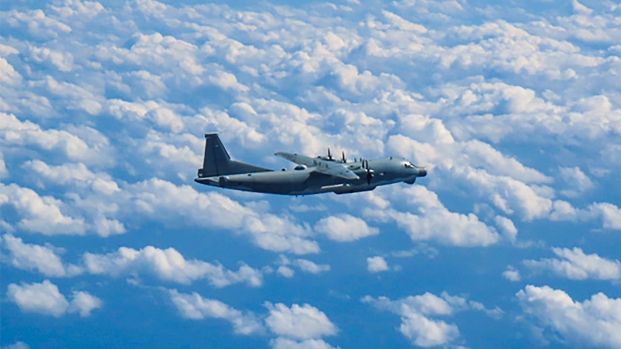
A few dozen miles to the west, another machine flies in the opposite direction. It is a Chinese WZ-7 Soar Dragon, distinguishable by its unusual joined-wing design that looks like a diamond sliced out of black obsidian. It too flies without a pilot. It too sweeps the ocean below with synthetic aperture radar, mapping every metallic hull, every radar emission, every whisper of electromagnetic energy bouncing off the waves. To explore the bigger picture, we recommend the excellent analysis by The New York Times.
They do not touch. They do not talk. They drift past each other like iron ghosts in the night, silent sentinels of a quiet war that is reshaping the balance of global power while the rest of the world sleeps.
The Invisible Grid Over the South China Sea
For decades, military power in the Pacific was measured in tonnage and iron. You counted the aircraft carriers. You measured the length of battlecruiser hulls. You plotted the range of heavy bombers stationed on tropical island airstrips.
That math is dead.
Today, control over the waters surrounding Japan, Taiwan, and the South China Sea is defined by a invisible grid of signal data. If you can see the enemy first, you win. If you can blind the enemy first, you survive.
This is why the skies over the Western Pacific have grown extraordinarily crowded over the past twenty-four months. The United States and China have entered a high-stakes, silent race to deploy long-range, high-altitude unmanned aerial vehicles across the maritime chokepoints of Asia.
Consider what happens when a human pilot flies a reconnaissance mission near disputed airspace. Every second inside that cockpit is tick-tock accounting of biological limit. A human pilot bleeds focus after six hours. A human pilot requires life support, pressurized suits, emergency ejection systems, and rescue plans. Most importantly, if a human pilot is shot down or intercepted too aggressively, the crisis escalates instantly into a headline event with names, faces, and crying families.
Unmanned aircraft strip that equation down to pure strategy.
A Global Hawk can loiter over a single patch of ocean for over thirty hours without landing. China’s Soar Dragon and its longer-range sibling, the GJ-11 Sharp Sword, can hug the outer edges of Japanese air defense identification zones for a day at a time, relaying real-time targeting data directly to land-based anti-ship ballistic missile batteries hidden deep in the hills of Fujian province.
They are infinite eyes. They do not get tired. They do not sweat. And because there is no flesh inside them, both nations are willing to push them far closer to the edge than they ever would a manned aircraft.
The Salt Air and the Sensor Lens
To understand how close this grid sits to everyday life, you have to look at the map from a fisherman’s perspective.
In the Ryukyu Islands of southern Japan, life has long moved to the cadence of the tides. Fishermen launch their boats before dawn, navigating shallow reefs that have sustained their villages for centuries. But over the last two years, the sky above their traditional grounds has changed tone.
On clear afternoons, you can spot them: faint white contrails carved impossibly high in the blue, straight lines drawn with a ruler from north to south, then east to west.
Below those contrails, the sea is choked with unseen waves of radar energy. When an American MQ-4C Triton sweeps past the Miyako Strait—a critical maritime bottleneck between Okinawa and Miyako Island—it is not just taking photos. Its radar pulses cut through cloud cover, rainstorms, and sea spray to construct a digital mirror of the water’s surface.
Every fishing vessel, every patrol craft, every container freighter is cataloged, identified, and fed into an algorithmic targeting bank.
China views these flights as a digital blockade. In response, the People's Liberation Army Air Force has expanded its own unmanned footprint exponentially. Chinese drones now regularly circuit the skies around Taiwan, passing through the Bashi Channel to the south and sweeping up past the Senkaku Islands to the north.
What looks on a news map like a simple line drawing of flight paths is actually an intricate game of digital territory tagging. Every flight pushes the boundary of what is considered "normal" operational presence. If a Chinese drone flies along the edge of Japanese airspace three hundred days a year, the three-hundred-and-first flight no longer triggers an emergency response. The extraordinary becomes routine. The invasive becomes background noise.
The Cold Friction of Automation
There is a dangerous paradox at the heart of autonomous military expansion.
We build pilotless machines to remove human risk. Yet, by removing human risk, we remove the very buffer that prevents minor miscalculations from spiraling into total conflict.
Think about a traditional aerial encounter. Two fighter jets meet over neutral waters. The pilots can see each other's faces through the glass of their canopies. They can watch hand gestures. They can read body language. If one pilot rocks their wings, it signals intent. If one maneuvers too aggressively, the other can make a human judgment call: Is this person panicking, or are they trying to kill me?
An algorithm does not make that distinction.
An electronic warfare suite mounted on an autonomous drone responds to threats based on programmed logic gates. If a Chinese drone detects a radar lock from a Japanese F-15 scrambler, it does not feel fear. It executes its defensive electronic countermeasures instantly, jamming signals or altering flight paths according to strict code.
When machines interact with machines at nine hundred kilometers per hour, event timelines compress from minutes to milliseconds.
Last year, encounters between military craft in the South China Sea rose dramatically. Patrols by American UAVs were met by Chinese interceptors, and Chinese surveillance drones were shadowed by Japanese fighters. On several occasions, jets passed within meters of autonomous wings.
If a fighter jet clips the wing of a drone, no pilot dies in the sky. But the machine plunges into the sea carrying classified sensors, specialized encryption hardware, and proprietary intelligence code.
What happens next?
The scramble to recover that wreckage off the sea floor becomes a flashpoint. Ships gather. Warning shots are weighed. Radar locks are engaged. The presence of the drone was meant to lower the stakes of intelligence gathering, but the loss of the drone creates an immediate, high-stakes military standoff.
The Geometry of Escalation
The expansion of drone routes near Japan and through the South China Sea is not occurring in a vacuum. It is the direct response to a fundamental shift in modern warfare geography.
China’s military strategy relies heavily on what analysts call Anti-Access/Area Denial (A2/AD). The goal is simple: create a bubble of strike capability so dense and so long-ranged that foreign navies cannot enter the Western Pacific without facing catastrophic risk. The core of this strategy depends on long-range anti-ship missiles like the DF-21D.
But a missile with a two-thousand-kilometer range is completely useless if you cannot see what you are aiming at past the horizon. The Earth curves. Ship-borne radar can only see so far.
Drones are the fix for the curve of the Earth.
They are the forward spotters for the long-range artillery of the twenty-first century. By keeping a constant swarm of high-altitude surveillance UAVs positioned across the first island chain, Beijing aims to turn the Western Pacific into a lit room where no surface ship can move undetected.
Conversely, the United States and its allies use their own drone fleets to map those exact Chinese targeting networks. By monitoring where Chinese radars light up and tracking how Chinese ground forces respond to surveillance flights, Western intelligence constructs a dynamic map of the adversary’s digital nervous system.
It is a game of blind man's bluff played with billion-dollar optics.
What Remains When the Lights Go Out
Stand on the coast of Yonaguni, Japan's westernmost inhabited island, on a clear morning. Taiwan sits just one hundred and eleven kilometers across the blue water, visible as a dark, mountainous silhouette on the horizon.
From this peaceful shore, you cannot hear the jet engines overhead. The high-altitude drones fly too high for the human ear to register. The air smells only of salt, crushed grass, and damp coral.
Yet, this small strip of land sits squarely inside the most densely monitored airspace on the planet.
Above the clouds, the machines continue their silent choreography. They loop, track, record, and transmit. They do not rest, because their operators work in shifts, swapping seats in ground control stations across different time zones without missing a single frame of high-definition imagery.
We often convince ourselves that the future of conflict will arrive with a sudden, thunderous flash. We picture dramatic declarations, fleet maneuvers, and alarms blaring in war rooms.
The reality over the West Pacific suggests something far stranger, far quieter, and far more unsettling.
The war for the Pacific has already begun, but it is being fought by iron ghosts that do not breathe, operating on algorithms written thousands of miles away, quietly drawing lines across the sky until the sky itself is fully claimed.