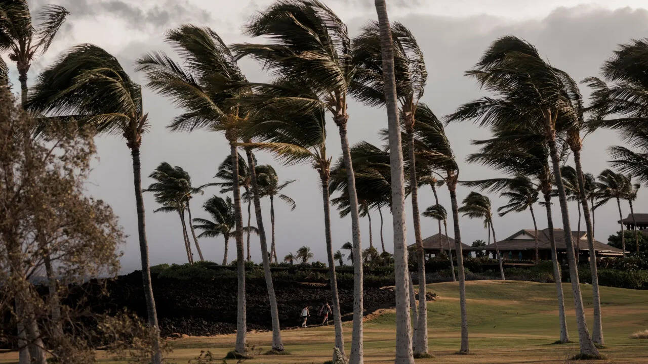
Most people think Hawaii is immune to direct tropical strikes. They picture gentle trade winds, passing showers, and sunshine. Hurricane Lala shatters that illusion completely. Skirting past Hawaii's Big Island as a formidable Category 1 system, this storm brought the region face-to-face with a rare and historic threat that weather experts have warned about for years.
When you look at Pacific storm patterns, direct hits on the islands are statistical anomalies. Yet, the reality on the ground during Lala proved that a storm doesn't need to score a textbook landfall to devastate local infrastructure. With torrential rains topping 20 inches in places like Volcanoes National Park and wind gusts screaming past 100 mph on the upper peaks, the storm exposed deep vulnerabilities in how isolated island communities handle extreme weather.
The Weight of History and Rare Storm Tracks
Why is Hurricane Lala such a big deal? Context matters. A hurricane hasn't made landfall anywhere in the Hawaiian chain since Hurricane Iniki tore through Kauai in 1992, causing billions in damage. When you narrow the focus to the Big Island specifically, a direct hurricane hit hasn't happened in 155 years, with historical records pointing back to an 1871 Category 3 strike on the northeastern coast.
Most Central Pacific storms historically weaken or curve away before reaching land. They hit hostile wind shears or cooler waters. Lala broke that script. It intensified right on the doorstep of the state's largest island, packing sustained winds of 75 to 80 mph and throwing emergency planners into immediate crisis mode. Governor Josh Green didn't mince words, calling it an enormous storm and urging residents to hunker down immediately.
Why Margins of Error Are Shrinking
People living on the Big Island are notoriously self-reliant. If you talk to lifelong residents who've weathered decades of tropical depressions, they stock up on fuel, check their generators, and keep large water tanks full. But self-reliance has limits when infrastructure fails on a mass scale.
During Lala, tens of thousands of utility customers lost power as falling trees snapped lines along coastal and mountain roads. Hilo International Airport and Ellison Onizuka Kona International Airport shut down entirely. Commercial ports locked their gates.
The geography of the Big Island makes it uniquely vulnerable. You have steep mountain terrain juxtaposed with off-grid communities living in areas prone to flash floods and sudden mudslides. When hourly rainfall rates hit several inches, dry gullies transform into raging torrents within minutes.
The Hidden Danger of Secondary Hazards
Experienced meteorologists will tell you that focusing solely on the eye of a hurricane is a dangerous mistake. Lala proved this point vividly. Even as the core skirted the southern tip near South Point, the outer bands unleashed a chaotic mix of hazards:
- Torrential Downpours: Isolated spots across higher elevations faced projections of up to 25 inches of rain, creating severe landslide risks.
- Extreme Surf: Destructive waves and powerful rip currents battered coastlines, making ocean access fatal.
- Wildfire Triggers: High winds passing over dry terrain spiked fire danger, a terrifying echo of the atmospheric conditions that fueled past tragedies like the Lahaina fire.
This multi-threat profile catches people off guard. You prepare for wind, and then water cuts off your road access. You clear your gutters, and then flying debris takes out your power grid.
Preparing for the New Normal
Climate patterns across the Pacific are shifting. Warmer ocean temperatures feed storms more energy, increasing the odds of rapid intensification right when systems approach land. If you live in Hawaii or own property in island zones prone to extreme weather, old assumptions no longer apply.
Check your insurance policies to see what wind and flood coverage actually includes. Keep at least two weeks of emergency supplies on hand, because supply chains to islands shut down instantly when ports close. Clear immediate tree hazards away from your roof, and never drive through standing water, no matter how shallow it looks. Pay attention to local emergency alerts the moment they drop, because when a historic storm arrives, you won't have time to catch up.


