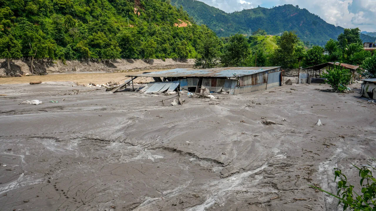
Catastrophic flash floods along the Nepal-China border have left over 500 people dead and more than 1,500 missing, with rescue operations temporarily paralyzed by an overflowing natural barrier lake. Triggered by a massive glacier collapse and bedrock failure in Tibet that registered a magnitude 5.2 seismic shock, the initial torrent of ice, mud, and water obliterated villages, bridges, and infrastructure. Now, a massive debris-clogged reservoir swelling past 2.5 million cubic metres threatens to unleash a secondary wave down the Bhotekoshi and Trishuli river valleys, forcing frantic evacuations and exposing the severe limits of high-altitude disaster response.
The Anatomy of a High-Altitude Catastrophe
Glacial lake outburst floods are rarely simple acts of nature. They are complex thermodynamic and geological failures. High in the Himalayas, rising temperatures destabilize ice masses anchored to steep, fractured bedrock. When a section of a glacier collapses with enough force to mimic an earthquake, millions of tons of rock and ice pulverize into slurry.
This debris charge races down narrow mountain gorges at terrifying speeds. In the case of the border disaster near Gyirong Port and Nepal's Rasuwa district, the slurry didn't just pass through—it choked the narrow river valleys. Tons of earth and boulders wedged tightly between canyon walls, forming an impromptu dam.
Behind this unstable wall, water pools rapidly. By late August, monitoring stations registered the volume of this makeshift reservoir swelling past 2.5 million cubic metres. A natural dam built of loose sediment and shattered stone possesses zero structural integrity. When inflow outpaces seepage, overtopping is inevitable. The moment the water spills over the crest, it begins to erode the loose material from the bottom up, creating conditions for a sudden, catastrophic breach.
When Rescue Becomes the Risk
Search and recovery operations in the Himalayas operate on razor-thin margins. When automated monitoring systems and drone surveillance confirmed that the barrier lake was actively overflowing into the Bhotekoshi River, the mission transformed instantly from rescue to survival.
Sirens wailed in mountain towns like Bidur, prompting residents and emergency crews to scramble up steep hillsides with whatever they could carry. Chinese state media reported that rescue personnel and heavy vehicles stationed near the border had to withdraw to designated safe zones. Nepalese authorities ordered a mandatory halt to search operations, pulling teams away from pulverized hydropower tunnels and mud-choked ravines where dozens of victims remained trapped.
This dynamic illustrates the brutal calculus of secondary disasters. Every hour spent waiting out a potential barrier lake breach is an hour lost for trapped survivors pinned beneath heavy timber and dense silt. Yet pushing teams forward into a gorge downstream of an unstable 2.5-million-cubic-metre water bomb is a death sentence.
Geopolitical Friction and Logistics in the Valleys
Disaster response across an international boundary demands tight coordination. Here, geography and bureaucracy complicate an already desperate situation. Gyirong Port, a vital commercial and pilgrimage artery connecting Tibet to Nepal, became an isolated island of debris.
While international offers for specialized search-and-rescue assistance poured in from global capitals, the Nepalese government opted to lean primarily on its internal security forces, deploying tens of thousands of personnel to comb remote, cut-off valleys. Meanwhile, Chinese engineering corps utilized 3D modeling and aerial surveys to map the unstable barrier lake from above, attempting to calculate whether controlled drainage was mathematically possible before an uncontrolled blowout occurred.
The human cost extends far beyond local residents. Hundreds of foreign nationals—including tourists, workers, and religious pilgrims traveling toward sacred sites like Mount Kailash—were caught in the path of the initial surge. Families across multiple continents spent anxious days checking fragmented casualty lists, as communication lines remained severed by washed-out fiber-optic cables and destroyed roadways.
The Long-Term Vulnerability of Himalayan Infrastructure
Engineering projects tucked into steep Himalayan corridors face an existential threat that traditional environmental impact assessments rarely capture with sufficient weight. Hydropower installations, such as the Upper Trishuli-1 project site where workers were trapped in mud-filled tunnels, are designed to harness the immense energy of mountain rivers. They are rarely engineered to withstand a multi-million-tonne wall of liquid rock and pulverized glacier ice moving at terminal velocity.
As global temperatures continue to alter high-altitude cryosphere dynamics, the frequency of glacial detachment and barrier lake formation is accelerating. Communities built on alluvial fans and narrow river terraces live downstream of ticking clocks. Engineering solutions require real-time satellite telemetry, automated early-warning sensors wired into deep river canyons, and pre-planned evacuation routes that account for minutes—not hours—of warning time.
Heavy machinery works furiously to carve temporary access roads through the rubble near Gyirong, but the landscape itself has been fundamentally redrawn. Until the barrier lake drains safely or stabilizes completely, the valleys remain suspended in a tense holding pattern, waiting to see whether the mountain will hold or break again.