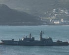
Operational Signaling in International Waters
The execution of a live-fire naval exercise 45 nautical miles off the coast of the United Kingdom represents a deliberate calibration of maritime domain posture. Under the 1982 United Nations Convention on the Law of the Sea (UNCLOS), foreign naval forces retain freedom of navigation and overflight within another nation’s Exclusive Economic Zone (EEZ), which extends up to 200 nautical miles from the baseline. Operating 45 miles off the baseline positions a warship well outside territorial seas (12 nautical miles) while remaining deep inside the economic and security observation envelope of the littoral state.
Such exercises are rarely tactical assessments of weapons performance. Instead, they function as high-value political and military signaling tools designed to achieve three specific strategic objectives:
- Boundary Testing: Assessing the baseline response times, monitoring capabilities, and operational readiness of host air and maritime interception forces.
- Deterrence Projection: Demonstrating offensive payload readiness and operational range within immediate reach of critical civilian and military infrastructure.
- Strategic Distraction: Forcing the host nation to reallocate intelligence, surveillance, reconnaissance (ISR), and surface assets away from primary operational theaters.
The Three Components of Maritime Power Projection
Evaluating the impact of near-shore naval maneuvers requires analyzing three primary operational variables: spatial proximity, weapon engagement zones, and response doctrine.
Spatial Proximity and Reaction Windows
A distance of 45 nautical miles translates to approximately 52 statute miles. For high-speed surface vessels, this distance reduces reaction horizons for coastal defense nodes significantly. For anti-ship cruise missiles (ASCMs) or land-attack cruise missiles (LACMs) traveling at high subsonic or supersonic speeds, flight time from launch to target ranges between two and six minutes.
This proximity compresses the target nation's Observe-Orient-Decide-Act (OODA) loop. Intelligence networks must instantly transition from routine maritime domain awareness monitoring to active threat tracking, increasing operational friction and risk of miscalculation.
Weapon Engagement Zone (WEZ) Overlap
Modern surface combatants carry vertically launched systems capable of deploying mixed payloads. When a live-fire event occurs 45 miles off a coast, the WEZ of the participating vessel overlaps directly with crucial shore-based assets:
- Air Defense Intercept Grids: Live-fire surface-to-air missile (SAM) engagements require local airspace reservation (NOTAMs). This restricts commercial aviation routes and forces rerouting along high-density corridors.
- Subsea Infrastructure: The deployment of anti-submarine warfare (ASW) rockets or live munitions occurs in proximity to critical undersea communications cables and energy pipelines.
- Command and Control (C2) Nodes: The effective range of onboard strike systems extends hundreds of miles inland, placing central military headquarters and logistics hubs within non-standard engagement vectors.
Royal Navy and NATO Escalation Protocols
When foreign surface combatants conduct weapons firing within sensitive EEZs, western naval doctrine dictates a structured, proportional response ladder designed to prevent unintended escalation while maintaining air and surface dominance.
- Shadowing and Persistent Escort: Deployment of Type 23 frigates, Type 45 destroyers, or offshore patrol vessels (OPVs) to maintain visual and radar contact.
- Airborne Surveillance: Deployment of P-8A Poseidon Maritime Patrol Aircraft (MPA) to monitor subsurface activity, track acoustic signatures, and intercept electromagnetic emissions.
- Electromagnetic Spectrum Management: Passive collection of the foreign vessel’s fire-control radar signatures (SIGINT/ELINT) to update national electronic warfare databases.
Escalation Cost Function and Strategic Assessment
The primary failure of standard reporting is treating near-shore live-fire drills as mere provocations rather than calculating the strategic cost-benefit ratio for both the operating power and the coastal nation.
$$\text{Escalation Risk} = \frac{\text{Proximity} \times \text{Weapon Lethality}}{\text{C2 Transparency} \times \text{Warning Time}}$$
As proximity decreases and warning times shrink, maintaining C2 transparency becomes vital to prevent defensive systems from automatically classifying an exercise as an incoming strike. When live ammunition is introduced, the baseline threat level scales exponentially rather than linearly.
Operational Limitations of Strategic Proximity Exercises
While near-shore firing demonstrates reach, it incurs distinct operational liabilities for the deploying fleet:
- Signature Exposure: Operating close to host-nation radar networks allows coastal defenses to capture precise radar cross-section (RCS) data, infrared signatures, and acoustic profiles across various sea states.
- Tactical Vulnerability: A single surface vessel operating near foreign airbases and coastal battery ranges operates inside the host nation's kill web, eliminating tactical surprise.
- Resource Depletion: Transiting long distances to execute localized firing exercises drains blue-water logistical support systems and accelerates hull and propulsion maintenance cycles.
Strategic Action Plan for Maritime Domain Defense
Litoral defense doctrine must adapt to the normalization of gray-zone maneuvers within the EEZ. Maritime defense planners should prioritize three operational shifts:
First, transition static coastal radar monitoring to dynamic, autonomous uncrewed surface vessels (USVs) capable of maintaining continuous visual and acoustic contact without tying up high-value surface combatants like destroyers. Second, automate real-time integration between civilian air traffic networks and military air defense networks to manage airspace closures immediately upon the issuance of non-standard maritime warnings. Third, systematically archive the electromagnetic and acoustic signatures gathered during these close-encounter events to optimize electronic countermeasures across the broader NATO alliance grid.