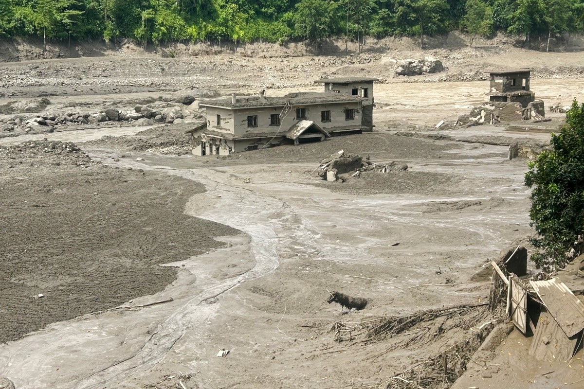
Ground sensors don't always tell the whole truth on the first pass. When early automated monitors flashed warnings of an earthquake near the Nepal-China border, automated news feeds instantly blamed tectonic activity for the disaster unfolding downstream. But reality proved far more violent and unusual.
The United States Geological Survey had to step in with a major correction. That sudden morning shaking wasn't an underground fault snapping loose. It was an immense mass of rock, ice, and debris tearing down a Himalayan mountainside. If you enjoyed this piece, you might want to check out: this related article.
Understanding what actually happened matters. When natural disasters hit remote regions, getting the mechanics right helps communities prepare for the next crisis instead of fighting ghosts of the past.
How a Landslide Fools Seismic Monitors
Automated earthquake detection systems look at data waveforms to map underground movement in seconds. But physics can play tricks on remote instruments. When millions of tons of material drop off a high mountain ridge, the kinetic impact sends powerful low-frequency waves rippling through the crust. For another look on this development, see the latest update from NPR.
Initially, monitoring networks registered the event near the border as a magnitude 4.4 earthquake. Deeper analysis of long-period seismic waves proved otherwise. The seismic energy signature came entirely from surface movement, registering the equivalent of a 5.2 magnitude event once seismologists factored in the massive rock-ice avalanche.
A glacier high above the Lhende Khola river valley had collapsed. That failure hurled an enormous volume of material into the drainage basin, choking waterways and sending devastating flash floods tearing through districts like Rasuwa and Dhading.
The Danger of Liquid Concrete Floods
People living downstream didn't have time to look at seismograph readings. The sudden surge behaved less like normal river overflow and more like an advancing wall of liquid concrete.
When a massive debris flow hits narrow mountain gorges, standard evacuation timelines fail. Water mixed with pulverized rock, mud, and shattered ice moves with terrifying speed. Entire sections of roads, bridges, and hydropower infrastructure vanished within minutes.
Rescue operations faced massive hurdles because communication lines went dark immediately. Helicopters became the only viable lifeline for reaching stranded survivors across rugged terrain where bridges had been swept completely away.
Why Himalayan Disaster Tracking Must Adapt
Mountain regions face compounding climate and geological pressures that traditional monitoring fails to catch early. Glacial thinning and shifting permafrost create instability that regular tectonic fault monitoring simply isn't designed to spot.
When organizations rely only on automated seismic triggers, emergency response units can end up looking for ground ruptures when they should be tracking upstream water blockages and slope stability. Experts warn that secondary flood risks often linger long after the initial impact because debris dams can temporarily trap water before breaching violently.
Clear data saves lives in the opening hours of a catastrophe. Correcting the record from a phantom earthquake to a massive slope failure points emergency planners toward the real hazard: fragile high-altitude cryosphere zones that demand constant satellite surveillance.


