The air tasted like copper and old ash long before anyone saw the flames.
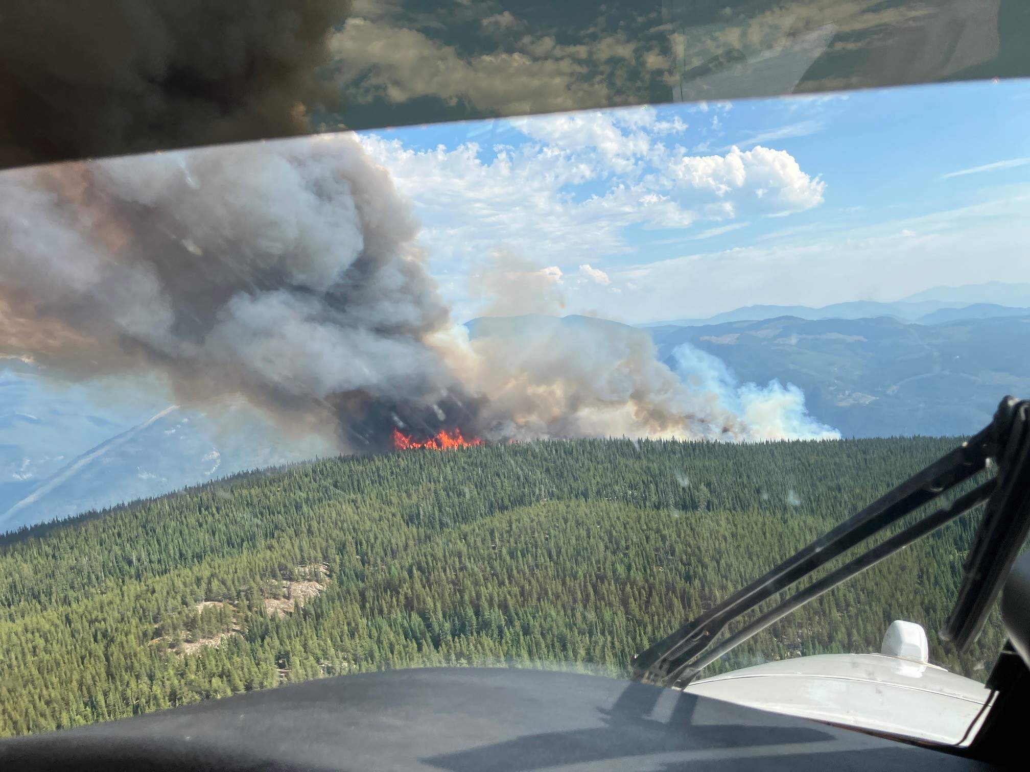
Up on the hills north of Castlegar, the Kootenay timber did not simply catch fire; it exhaled. Summer had baked the needles until they turned the color of dry bone, waiting for a single spark to rewrite the geography of the valley. When it came, it moved with a quiet, heavy determination, chewing through brush and old-growth timber alike until the perimeter was drawn in blood-orange light against the midnight sky.
By morning, the numbers arrived. One hundred and sixteen hectares.
To an algorithm, 116 hectares is a data point. A coordinate. A statistic neatly filed into a provincial update. But numbers do not capture the sound of a pine tree popping like a rifle shot under the thermal load. They do not measure the weight of an evacuation alert dropped into a local's phone at two in the morning, forcing families to make impossible choices about what fits in the trunk of a sedan.
I remember standing on a gravel pull-off years ago during a smaller blowup, watching the smoke boil over the ridgeline like an oncoming freight train. There is a terrifying intimacy to a wildfire in mountain country. The geography traps you. You look up at the walls of the valley, and you realize how thin the margin is between a quiet Tuesday and total displacement.
Consider what happens next when a fire hits this specific terrain.
Castlegar sits at the confluence of deep valleys and rushing rivers, a place where geography is both a sanctuary and a trap. When a blaze balloons to over one hundred hectares in steep, rugged backcountry, ground crews cannot simply walk up to the edge with a garden hose. They rely on heavy iron and calculated geometry. Air tankers buzz the ridge, carving white paths of retardant through the smoke, while hotshot crews hack fire guards with pulaskis and chainsaws, sweating through Nomex shirts in eighty-degree heat.
It is a war of inches fought against a relentless chemistry. Heat, oxygen, dry timber.
Behind the official mapping updates and the smoke reports lie the small, human geometries of crisis. Imagine a retiree sitting on a porch on the upper benches of Castlegar, watching the plume rise above the tree line. Every year the smoke returns earlier. Every year the window of safety feels a fraction narrower. You pack the photo albums. You load the dog into the back seat. You look back at the garden you planted in the spring, wondering if the wind will shift north or south by noon.
That is the invisible stake of the 116-hectare perimeter. It is not just about merchantable timber or provincial suppression budgets. It is about the collective holding of breath across an entire community, waiting for the wind to drop.
The BC Wildfire Service treats these events with clinical precision, mapping the spread through infrared flights and GPS tracks. Yet, out on the fire line, precision gives way to raw endurance. Smoke gets deep in your lungs. Ash cakes your eyelashes. The radio squawks with wind updates that change the game in a heartbeat.
And then, the quiet after.
When the smoke finally thers away and leaves behind a chalky, skeletal landscape of black sticks and grey earth, the rain eventually comes. It washes the ash down into the creeks, turning the runoff the color of strong tea.
The fire on the ridge north of Castlegar is a reminder that we are merely guests in a landscape that still remembers how to burn. The perimeter will be held. The smoke will fade from the valley floor. But the memory of that orange glow on the ridgeline stays in the grain of the town long after the crews pack up their gear and the maps are folded away.