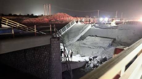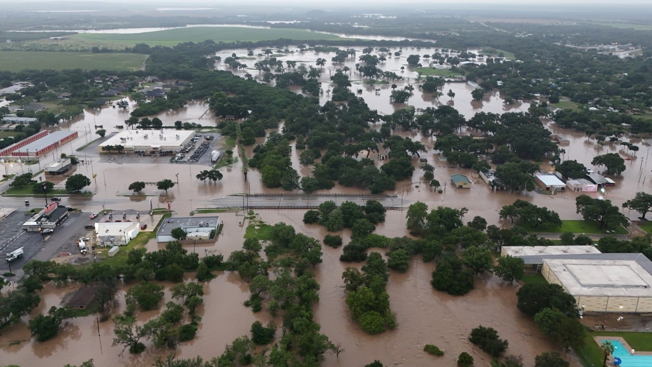
Texas is reeling from a devastating storm system that has claimed at least two lives, with meteorologists warning that more severe weather is on the way. But these deaths and the billions of dollars in recurring property damage are not merely natural disasters. They are the predictable consequences of systemic policy choices. As heavy rains continue to swell rivers and turn suburban streets into fast-flowing canals, the state is forced to confront a harsh reality. The rapid, unregulated development that has fueled the Texas economic boom is directly amplifying the destructive power of its storms.
For decades, the state has prioritized rapid expansion over water management. This strategy has turned pastureland into concrete, stripped away natural retention basins, and funneled millions of gallons of runoff straight into vulnerable communities. If you enjoyed this post, you might want to look at: this related article.
To understand why Texas drowns every time a major storm stalls over the Gulf Coast, you have to look beneath the surface of the standard weather report. It is not just a story of atmospheric pressure and moisture. It is a story of outdated engineering, toothless regulatory bodies, and a developer-friendly legal framework that treats water as someone else’s problem.
The Flawed Math of the Century Flood
Every time a storm inundates a neighborhood, local officials point to the heavens and call it a rare event. They use terms like "100-year flood" to imply that the disaster was an unavoidable anomaly, a statistical freak occurrence that could not have been anticipated. For another look on this event, check out the recent coverage from Al Jazeera.
This terminology is deeply misleading.
A 100-year flood does not mean a flood that happens once every century. It means a flood that has a 1% chance of occurring in any given year. That distinction is critical. Over the span of a standard 30-year mortgage, a home built within a designated 100-year floodplain has a 26% chance of being flooded at least once.
Worse still, the historical data used to calculate these probabilities is dangerously out of date. Many flood insurance rate maps rely on rainfall data gathered decades ago. They do not account for the rapid warming of the Gulf of Mexico, which feeds stronger, wetter storms directly into the Texas interior.
When a storm dumps twelve inches of rain in twenty-four hours, it is no longer a historical anomaly. It is the new baseline. By continuing to build roads and homes using obsolete precipitation models, developers are essentially designing infrastructure to fail under modern conditions.
The Physics of Concrete and Clay
To understand how development transforms a moderate rainstorm into a deadly flash flood, you have to look at the soil. Much of East and Central Texas is characterized by heavy clay soils. While clay does not absorb water as quickly as sandy soil, undeveloped prairie grass and forest land still act as massive natural sponges. The root systems of native grasses can extend several feet into the earth, creating pathways for water to seep deep into the ground.
When developers clear-cut these areas to build subdivisions, they strip away the topsoil and pack down the clay.
Then comes the concrete.
Highways, driveways, parking lots, and rooftops are known collectively as impervious cover. When rain falls on grass, a significant portion is absorbed or slowed down by vegetation. When rain falls on concrete, 100% of it becomes immediate runoff.
The math of this transformation is brutal. Replacing a single acre of natural prairie with asphalt increases the volume of runoff by a factor of five. It also dramatically increases the speed at which that water travels. Instead of slowly filtering through the dirt over days, millions of gallons of water rush off roofs and streets within minutes, overwhelming local drainage ditches and pouring into nearby creeks.
This creates a domino effect.
The water must go somewhere. If a master-planned community in a Houston suburb is built on elevated dirt pads to keep its homes dry, it simply sheds its water onto the older, lower-lying neighborhoods nearby. The new subdivision remains dry, while the families down the road find themselves wading through waist-deep water.
The Private District Loophole
In many states, county governments hold broad powers to regulate where and how new subdivisions are built. They can mandate strict drainage standards, limit the percentage of impervious cover, and prevent building in high-risk areas.
Texas is different.
Here, county governments have notoriously weak regulatory powers. They cannot pass zoning laws, and their ability to restrict development in unincorporated areas is severely limited. This regulatory vacuum has allowed the rise of a unique entity known as the Municipal Utility District, or MUD.
A MUD is a highly specialized political subdivision created to fund infrastructure in areas outside city limits.
- A developer buys a large tract of rural land.
- They petition the state to create a MUD.
- The district is authorized to issue tax-exempt bonds to pay for water, sewer, and drainage systems.
- These bonds are eventually paid off by the future homeowners through property taxes.
This system has been the primary engine of Texas's suburban sprawl. It allows developers to build massive communities miles away from existing city infrastructure, with little oversight from county engineers.
Because MUDs operate as independent entities, they often design their drainage systems in isolation. They build detention ponds designed to hold just enough water to satisfy minimal local standards, without considering the cumulative effect of dozens of similar districts dumping water into the same watershed. The result is a patchwork of uncoordinated drainage systems that frequently fail during regional rain events.
The True Cost of Cheap Protection
When a neighborhood floods repeatedly, the public clamors for structural solutions. People want bigger bayous, deeper channels, and massive concrete retaining walls.
These engineering projects are astronomically expensive, and they rarely solve the underlying problem.
Concrete channels are designed to speed water away from a protected area as quickly as possible. This works beautifully for the neighborhood immediately adjacent to the channel, but it exacerbates the crisis for everyone living downstream. By straightening and concreting natural bayous, engineers have essentially turned winding, slow-moving rivers into high-speed water highways. The water arrives downstream faster and in greater volume, causing catastrophic flooding in older, urban core neighborhoods that were built before modern drainage regulations existed.
Furthermore, the state's infrastructure is aging.
Many of the dams, levees, and reservoirs in Texas were built in the mid-twentieth century. They were designed for a state with a fraction of today's population and far less concrete. Today, these structures are being forced to hold back volumes of water they were never engineered to handle.
The cost of upgrading this infrastructure is staggering. Local tax bases cannot support it, and state-level funding is often distributed through a slow, bureaucratic process that prioritizes politically powerful regions over the areas in greatest need.
The Illusion of Safety in the Floodplain
Many homeowners buy properties outside the official 100-year floodplain believing they are safe from rising waters. This is a dangerous misconception.
During major storm events, a significant percentage of flooded homes sit outside the high-risk zones designated by the Federal Emergency Management Agency (FEMA). This happens because FEMA maps are backward-looking documents. They show where water has gone in the past, not where it will go in the future after another 10,000 homes have been built upstream.
Furthermore, the real estate market does not always incentivize transparency.
While Texas has recently strengthened its flood disclosure laws for home buyers, many renters remain entirely in the dark about a property's flood history. Landlords are not held to the same rigorous disclosure standards as home sellers, leaving low-income families particularly vulnerable to being caught off guard by rising waters.
The financial toll of this system is unsustainable.
When homes flood repeatedly, the National Flood Insurance Program (NFIP) often pays to rebuild them in the exact same spots. This federal subsidy shields developers and local governments from the financial consequences of poor planning. Instead of mandating that repetitive-loss properties be permanently bought out and returned to nature, the system encourages a cycle of build, flood, rebuild, and flood again.
The state cannot engineer its way out of this crisis solely with concrete and taxpayer-funded bailouts. Until Texas links its economic development policies with realistic water-management strategies, the state will continue to face the same deadly cycle. Nature does not respect property lines, and it does not care about municipal tax bases. Every acre of prairie paved over in the name of progress is a debt that will eventually be paid in floodwaters.